Wildwood Bayou 2016

Wildwood Bayou 2016

Wednesday, April 29, 2015

Sequoia National Park 2015


After Leaving Grand Canyon NP, we stopped at a little RV Park in Needles, CA and then on to a really nice park in Bakersfield, CA. The park in Needles was right on the Colorado River and featured great access to the river and a couple of beaches from which to enjoy the view. The park in Bakersfield was very unique. It was situated in the middle of an orange grove! On either side of the RV was an orange tree. We were just in time to pick some of the fruit. Also nearby was a fruit and nut outlet where we could buy a staggering variety of almonds, cashews, and pistachio’s along with oranges and citrus products. The park was very clean, well organized, and very friendly. We really enjoyed it. 

We left Bakersfield and took a short hop to the town of Three Rivers, CA. Here we stayed in a little RV park just outside of the south entrance to Sequoia National Park. We were reminded just how small a world we live in. Seems the manager of the park used to live in Wichita, KS and worked a short time for Boeing. It was a little before my time there but he was nice and gave us five days' stay for the price of four, just for our shared history. Nice guy! 

We started in to the park but soon found out that a winter storm had blown through the night before and chains were required for all folks traveling in the park beyond a certain point. Well we don’t make it a habit to carry chains or to be in a place where we need to use them. We could rent some from stores in Three Rivers for the “small” sum of $50 per day with a $100 deposit!!! We made a short stop at the visitors center for some information then headed back to the RV park for the night.

King's Canyon (small part of it!)
There are two separate but joined National Parks in the area. One is Sequoia, the other is Kings Canyon. We decided to take the day and explore Kings Canyon and see what it had to offer. We left the RV park and 1 1/2 hours later we arrived at the front gate! Didn’t expect that. We checked in with the Visitor's Center and the roads had been cleared and the requirement for chains was no longer in effect. We were free to drive about the park! The first thing we noticed was the dramatic drop in temperature. It was upper 60’s when we left, and here it was mid 40’s (glad we packed the jackets!). The road between the two parks is called the General's Highway. It gets its name from the two world record Sequoia’s that are linked by it. One is General Grant, which is one of the largest living trees in the world, located in Kings Canyon. The other is General Sherman, which is the world's largest tree by volume and weight, and is located in Sequoia NP. The immensity of the Sequoia is difficult to imagine if you haven’t seen one. These trees only grow between an altitude of 5,000 and 7,000 feet on the west side of the Sierra mountain range. Yet again on this trip, I am astounded and humbled by the grandeur and majesty of nature’s creations. The General Grant is 40 feet in diameter and is the 3rd largest tree in the world by volume. We then took the North Grove Loop hike. This is a nice 1 1/2 mile trail that gets you up close and personal with the “Big Trees” and a bonus quiet walk in the forest. So many tourists just drive up, look at Grant, then move on. While impressive, you can’t get very close to touch or look closely at it. On the Loop hike you can. We were the only ones on the trail and it was like we were totally alone in the woods with these silent giants. As we neared the end of our hike, the clouds began to roll in and the fog shrouded the forest. It was soooo cool!!

The fog rolls in.
Just the base of a fallen Sequoia!
The General Grant (and LTC Cunningham)

A perspective... Just how BIG these trees are!
We left General Grant and headed up the Kings Canyon Scenic Byway. It has that name for a reason. The views of the mountains, forests, rivers, and falls was different and surprising around every corner. We left the fog and clouds and were greeted by clear skies and awesome views. Again, pictures can’t come close to doing it justice. We seemed to stop at every turnout on the road yet saw something different each time. Stopping and getting out of the car allowed you to hear the wind in the canyon, the sound of water rushing over the rocks in the river bed far below, the cries of the birds as they circled above you. You could look at the different formations, colors, and consistencies in the rocks around you. It was amazing. By the time we finally got home, we were exhausted but consider the day a great success. 

Look at the ripples in this rock face!!

Grizzly Falls
More Kings Canyon
The next day dawned bright and sunny. We entered Sequoia and drove along the Generals Highway towards Moro Rock and Crescent Meadow. Moro Rock is a granite dome that dominates the landscape. By taking a 1/4 mile staircase that winds up 300 feet you are greeted with spectacular views of the surrounding mountains. 

Moro Rock (from a distance)
Some of the steps up Moro Rock.
From the top of Moro
Precariously perched boulders
General Sherman Sequoia
Crescent Meadow was a 1 mile hike around a fragile wetland surrounded by the large Sequoia groves. Along the route was Thorpe’s Log, a cabin built inside of a fallen Sequoia in 1860 and inhabited by a rancher until the Park was established in 1890. While on the hike, we came across a Grizzly sow and her cub. We were probably closer than those in the forest service would like us to be so we took some pictures and carefully hiked around the bears heading back to our car. We finally made it to the General Sherman tree trail and took the 1/2 mile trail down to the tree. This tree is 36.5 feet in diameter at the base and still growing. It is approximately 2,200 years old. 

Thorpe's Log
A small part of Crescent Meadow
Mama Bear
and Baby Bear
     After all of the hiking we must have frazzled our brains. We spent the next day doing some generic housekeeping and then left for our next stop, Yosemite National Park, the day following. Well, it seems that we had our dates mixed up and we left Sequoia a day early! Luckily for us our campsite near Yosemite was not crowded and they could accommodate our early arrival and the addition of one day to our stay. First time we have EVER done that! Guess we're having too much fun to be concerned with what day of the week it is!!

Monday, April 20, 2015

Grand Canyon National Park


     After leaving Carlsbad, the original plan called for us to go to a place called Ojo Caliente Mineral Springs. Here they have a hot mineral spring pool that is accessible to guests from the attached hotel and campground. Unfortunately, Mother Nature intervened and delivered a lot of wind, cold, and potential snow to the area. Because of that, we decided to miss out on the hot springs and head on towards the next planned stop... Grand Canyon National Park (GCNP). We stopped halfway there and spent the afternoon and evening in the Albuquerque Flying J parking lot due to some severe crosswinds. Our rig, along with all of the 18 wheelers along I-40, was getting tossed all over the road. Rather than "white knuckle" the drive for another four hours we pulled over to wait it out. The next morning dawned crisp and cool but relatively wind free. We easily made the drive into the town of Tusayan (which is just outside of the south gate entrance to GCNP) and checked in to a small but convenient RV park.


     As it turns out, this weekend is a free admission to the National Parks. What timing for us (said sarcastically!). We have an Annual Pass and expected to be met with small, early season crowds. But nooooooooo! Lucky for us the visiting public aren't very early risers. We were in the park by 8:30 am or so and found great parking near the Visitors Center and shuttle stop.

     But first, a little background... About 18 years ago we took the kids on a western National Park vacation that included Grand Canyon, Bryce, and Zion National Parks. We stayed in a pop-up camper in the park at their campground known as Trailer Village. At that time time, you could drive the entire south rim, stopping at any point of interest that you wanted to see or to hike along the rim trail. We also took a jaunt down part of Bright Angel Trail, a hike which our daughter holds against us to this day.

     Fast forward to today. The 7.8 miles of highway from Bright Angel Lodge and trailhead to Hermit's Rest is now only accessible by park shuttle from March 1 through November 30. Other shuttle stops have been added at various points of interest all along the south rim trail. You can park in the parking lots and ride the shuttle to the point you wish to visit, stay as long as you like, then catch the next shuttle. It is really quite efficient and effective. We chose to hike the rim trail. This trail, as the name implies, follows the rim of the canyon for almost 11 miles. On the first day we walked from the main Visitors Center to Mather point, a place everyone goes to for photos and to get their first view of the canyon. We continued walking from there to the South Kaibab Trailhead. A distance of about 3.75 miles. We stopped frequently along the way and soaked up the natural beauty that is the Grand Canyon. Luck was with us as there were clear blue skies, warm temperatures, light breezes, and very little polution to spoil our view. Once at the Trailhead, we took the shuttle to Yaki Point (the only way to get there). After sitting along the rim and watching nature at its finest, we loaded up on the shuttle and made the return trip to the Visitors Center.

As the name implies, the Rim Trail is along the rim! 
An interesting rock formation. Bet in not too many geologic years, it falls off.
Nature inspired awe! 
This young elk was right beside the trail. We walked by within 3 feet and she could have cared less.
The Mules of the Grand Canyon can be hired to take you down South Kaibab trail.  Here the "Mule Whisperer" gives a massage and encouragement to a recent returnee.


     Day 2 we took a different approach. Arriving early, we first took the shuttle out to Hermits Rest. We started our hike from there, thus being ahead of the crowds and working our way backwards. At Hermits Rest, there is a little Gift shop/Snack Bar that once was a stop for visitors around the turn of the 20th Century. The building is designed to look like it sprung out of the surrounding rocks and sports a very impressive fireplace (see the photo below).


     The views this day were just as impressive, if not more so, than those of Day 1. Along this trek you actually could see some of the Colorado River winding its way along almost a mile below.

Again, Rim Trail means on the Rim. (Granted I am a little bit off of the main trail but not by much!) 


We made it all the way!!
     As we neared the end of our chosen trail, the last 1.5 miles or so were mostly downhill. This was great as our poor feet were quite worn out. We also noticed that the views were not as spectacular and the trail was more crowded. This actually validated our decision to start at Hermits Rest. Had we not, our first 1.5 miles would have been mostly uphill and the views, while interesting, would not have been awe inspiring.

     At the conclusion of the hike, we stopped in "The Village", where the lodging, shopping, campgrounds, and railway station are located. Here we found the Pizza Pub inside of Maswik Lodge. We both had one of the best pizzas we have had and it really hit the spot! Refueled and refreshed (kind of) we set out on our next objective. Taking the shuttle to Yaki Point and waiting out the sunset. Here a small group of intrepid adventurers sit and chat, taking in the splendor and ever-changing colors of the canyon as the sun sinks slowly to the western horizon. During the last moments of sunset you can actually see the sun moving as it slips out of sight. Upon its departure, the assembled crowd broke into spontaneous applause. It was awesome!


     Day 3 saw us driving from Yaki Point out to the eastern end of the park along the Desert View Drive. Today was much more leisurely and we met some really neat folks along the way. At the Tusayan Museum, we met a couple of gentlemen from France here on vacation. Turns out one of them lives in Normandy just behind Omaha Beach. Misty went with us today and she soaked up several long belly rubs from these two guys. We met a retired couple at Grandview Point. He was wearing a hat with the "Screaming Eagle" emblem of the 101st Airborne Division. He was a proud former member and we exchanged a couple of "war stories." As so often happens to us, they asked us to take a picture of them with their camera. We obliged with one, then they asked for another. They said that they alway take two photos at each National Park they visit, one regular shot and one "kissing shot." It was very sweet. Once out at Desert View we took a tour of the Watchtower and headed back to our campground.

The Desert View Watchtower. Designed by the same lady who designed Hermits Rest. 
     After some housekeeping, we went back into the park and drove out to Grandview Point just before sunset. We weren't as much interested in the sunset tonight as we were in stargazing. While waiting for sunset, we chatted with a couple from Romania who were here on vacation. They were very friendly and we shared experiences from each of our countries. In the end, we exchanged contact information and if (or when) we ever go to visit Eastern Europe, they will give us some good local tips and hints. That's the really great thing about this traveling we do. Not only do we get to see unbelievable views and vistas, but we meet people from all around the world and get to know them (if only for a short while). Tomorrow, we pack up and continue our journey westward!

Sun beginning to set

What a display of color!

Crescent Moon and Venus in the Twilight

Count the stars... I dare you!

Wednesday, April 15, 2015

First Leg - Carlsbad and Roswell


     Well, it seems like it was only yesterday that we were arriving from our last summer's adventures. But now we have finished packing up and we said a temporary "Good-bye!" to our Texas home. We hit the road bright and early and headed westward through Houston and San Antonio, finally coming to an overnight stop in a rest area near Sonora, TX. Nice rest area and it was definitely time to take a break that day!


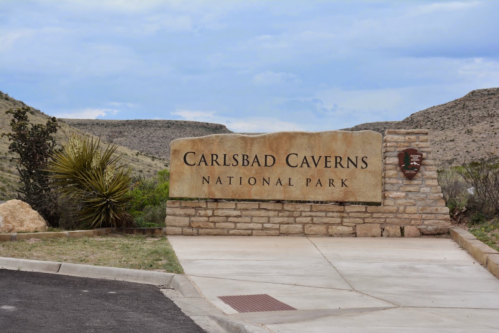
     You can see us in the photo above. We spent a nice restful evening and then continued on towards Carlsbad, NM. Seems odd that in all of our travels over the years, we have never been to the caverns here. We found a nice campground and got set up. Since we had some extra time, we took a quick recon trip to the National Park to check things out. We decided to take a couple of days to visit the caves. Tomorrow we will take the self guided tours that are available. The following day we will take a Ranger led tour and see part of the caverns that can't be seen if not on a tour.


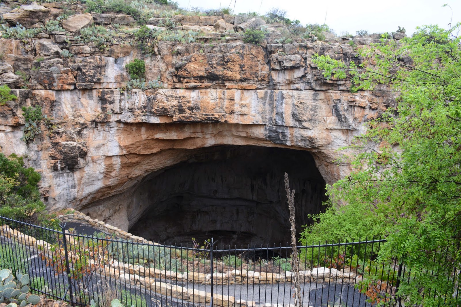
     Overnight a cold front blew through bringing with it rain and strong winds. Temperatures dropped to the low 40s overnight and the wind-driven raindrops flew through the air as if propelled from a shotgun. The flag at the Visitor's Center was hanging to the flagpole for dear life and visibility of the valley below was near zero! We had decided to go into the caves via the large natural entrance. It is through this entrance that the famous Carlsbad bats emerge at dusk during the summer. Much to our disappointment, they have not yet arrived this year.  The walk to the natural entrance normally is a nice desert garden trail that led into the opening. Today however, we were hit with winds of 50-60 mph and rain. We fought our way to the entrance and gladly got below ground. Here the winds and rain disappeared and the temperature was a relatively cool 56 degrees. Much more comfortable!

The Natural Entrance
     The trail into the cave is steep and has several switchbacks but it is paved and relatively easy to navigate. There are not a lot of cave formations on the way down (like stalactites, stalagmites, columns, and curtains). This cave is unique in that it was formed by hydrogen sulfide gas that combined with water and oxygen and made sulfuric acid. This acid ate away at the limestone and formed many of the caverns. Then, over time, groundwater began to seep in and that,s when the cave formations began. So it is unlike other caves in the southeastern US that were formed and "decorated" by the forces of water. Huge boulders lie on your path downwards and the trail weaves around them. Finally you end up 750 feet below the surface at the crossroad junction. One direction leads to the gift shop and snack shop where you can dine in a huge underground dining hall. This way also leads to the easier way in and out of the caves... the elevators! The other path leads you on a circuitous route around the "Big Room." This cavern is about the length of 14 football fields. If you walk the entire trail around it you will cover about 1.3 miles. One of the interesting things that I observed is that this is the only cave that I have been into where folks with disabilities could easily get around. The trail is relatively flat and level and can accommodate wheelchairs. The aforementioned elevator runs from the Visitor's Center down to the lower level and opens up at the snack shop. This makes for a comfortable ride down for those who can't or don't want to take the hike in from the Natural Entrance.


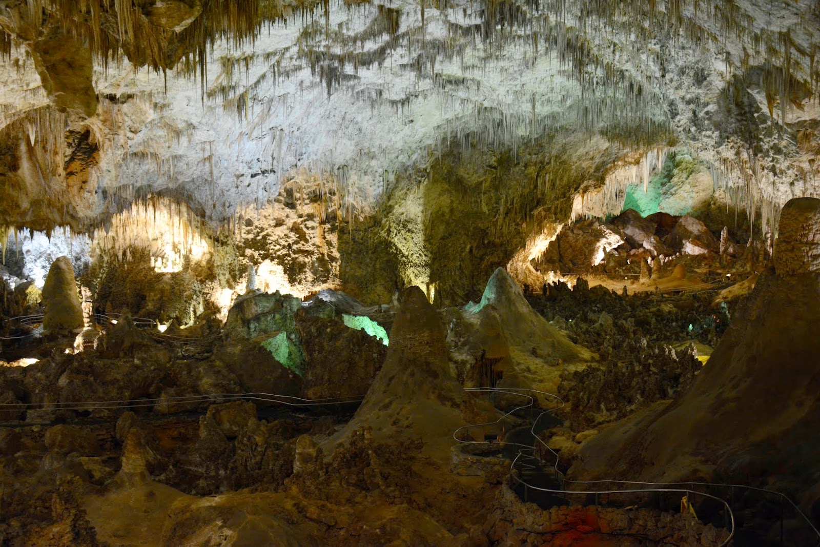
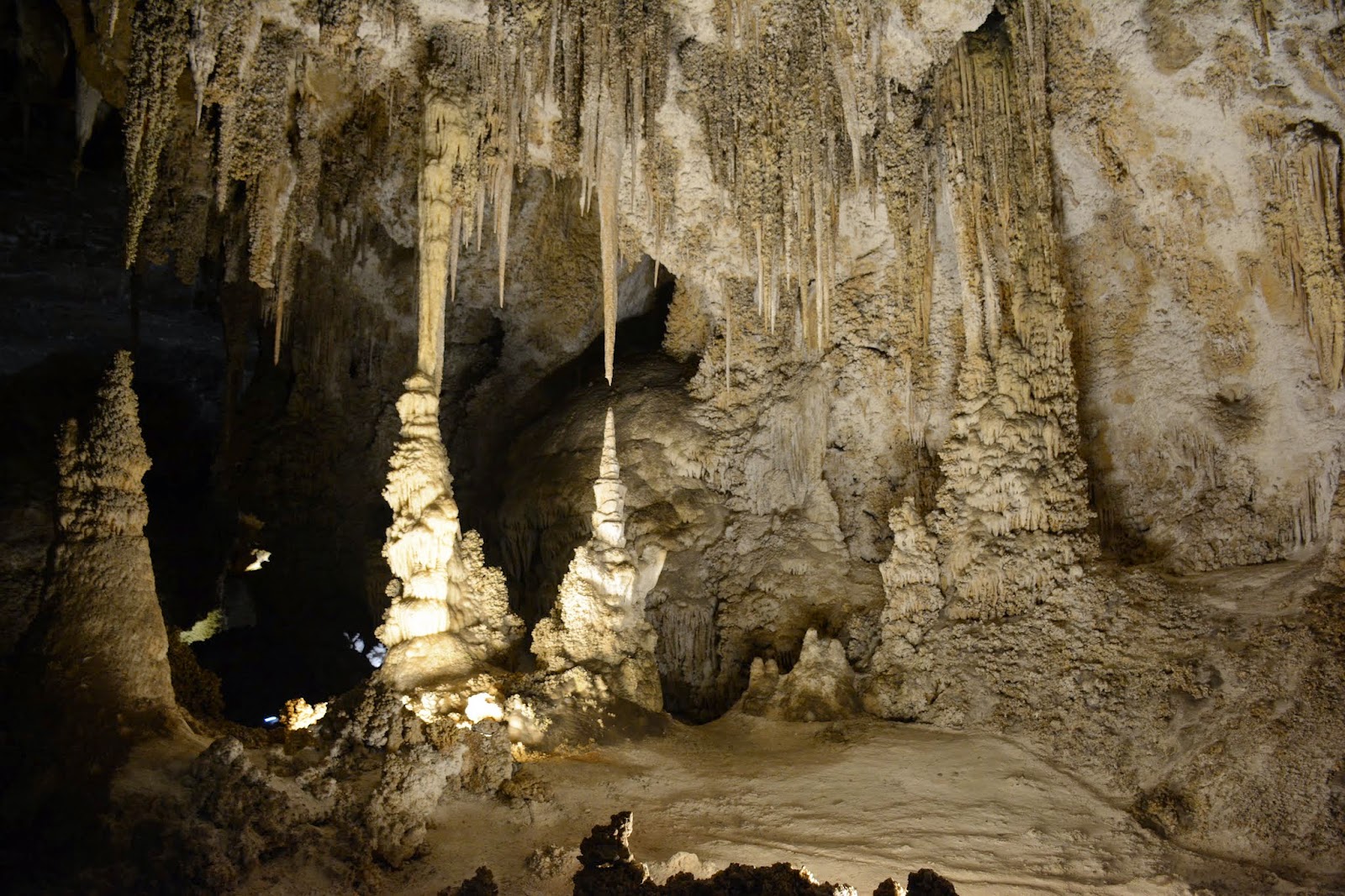
     The sheer size of this cavern is impossible to put in a picture. The photo above looks out along a portion of the Big Room. In the lower right corner you can just see the silver handrails that line the path. The visible portion is probably 20 or 30 feet long. So that gives you some perspective. But look at the decorations in the picture.  Stalactites large and small hang from the ceiling. Stalagmites come up from the floor in copious quantities and unlimited shapes. Sometimes they come together and form a column that reaches from floor to ceiling. The best part--you get to wander around through it all!!! While there were a lot of cars in the parking lot and we passed a lot of people, there were times that we were the only folks on the trail. It was like we had the cave all to ourselves.


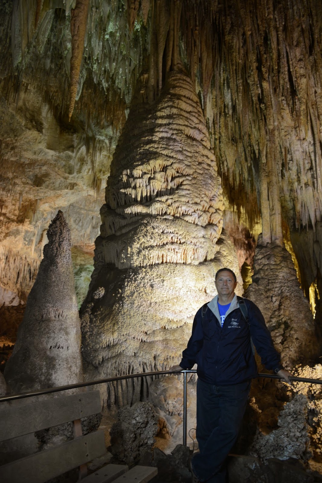
     Behind me in the photo above is just one of the columns in the Big Room. It gives you some perspective of the size and otherworldly beauty of the cave. Look at all of the stalactites over my head. Kind of like some medieval torture device.


     OK, the photo above is of a formation called "The Caveman." If you look at it just right,' Star Wars fans, it looks to me like Chewbacca gazing to the viewers left. But, that's just me.

Chinese Theater

     Here again are just some of the features and colors. The features in the Chinese Theatere are 6-7 feet tall. The column on the right of the above photo is 60 feet tall!! Unbelievably impressive! We took over 100 photos and they don't begin to give you the feel of the size and sheer volume of the cavern. You will just have to come see it for yourself!


     The next day dawned magnificent. Sunshine abounded and the temperatures rebounded nicely. We toured the caves and then toured the Big Room again (one, to enjoy the scenic wonder of the cavern and two, to play with exposures and experiment with lighting for photos).  On the way back to our campground, we stopped to see the desert in bloom. One good thing about the rains this time of year, the desert flowers are coming out all over. Carpets of purples, blues, yellows and oranges can be seen all around. Even the yuccas are in bloom.


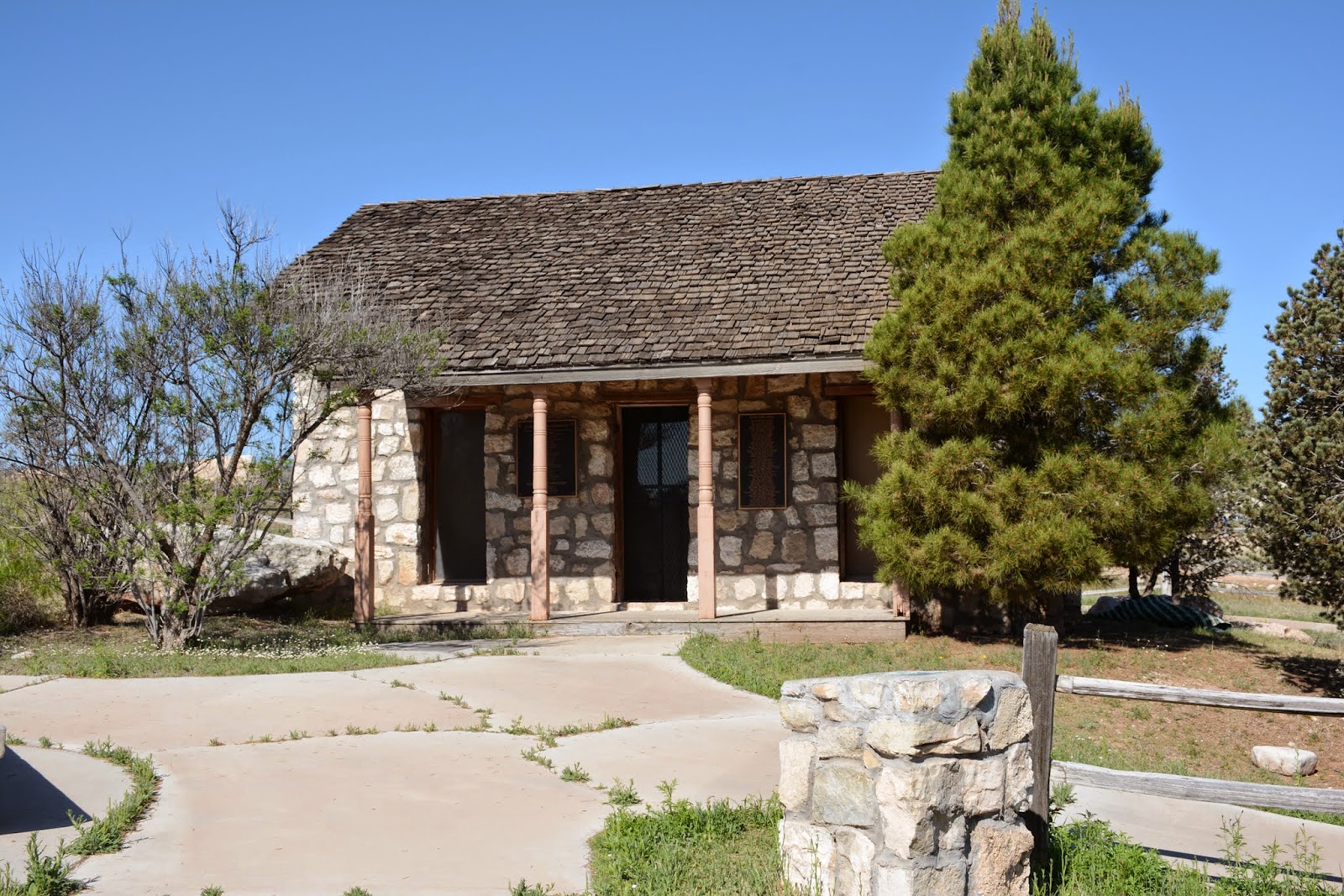
     We had originally planned on heading to northern New Mexico, to a mineral spring spa called Ojo Caliente. The weather had other plans. Seems that there is a large Canadian cold front coming through and it is bringing with it high winds, freezing temperatures, and possibly some snow. We put our heads together and decided to drop our northern New Mexico stop and instead stay an extra day in Carlsbad and add a day to our stay at the Grand Canyon. So with that extra day, we jumped out and took a day trip to Roswell. The first stop of the day was the Eddy House. This house was owned by Charles Eddy in the mid 1880's. Robert Tansill and his family spent the winter of 1888 in this house. Tansill was instrumental in the settlement of the town of Eddy which later was renamed Carlsbad.


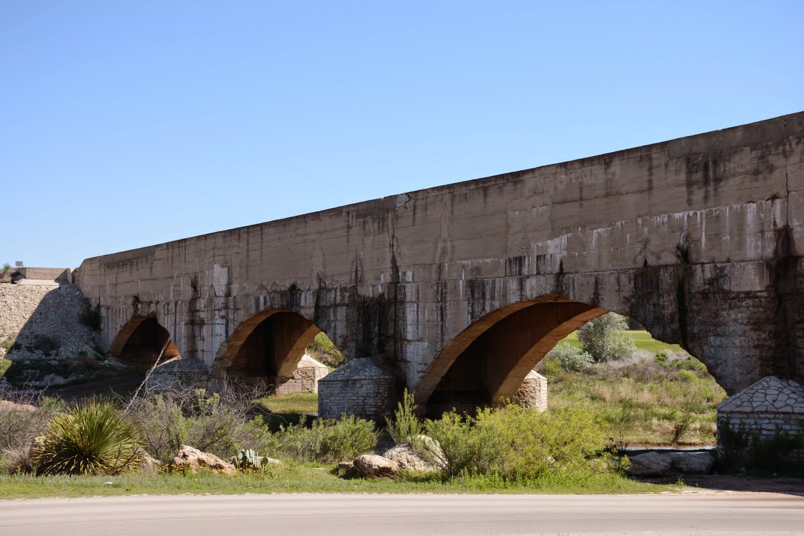
     Next stop was the concrete flume. This structure was originally made of wood in 1890. It was washed away by a flood in 1902 and replaced with this concrete structure in 1903. At the time it was built, it was the largest concrete structure in the world. It carries water from the Pecos River as part of the Carlsbad Irrigation District. It was once featured on Ripleys Believe It or Not as the river that crosses itself.

River water flowing into the flume
     Our last stop was the city of Roswell, made famous by the alleged crash of a UFO in 1947 near the city. Supposedly there were five bodies of aliens found, four dead and one still alive. All evidence of the crash was secured and sanitized by the Air Force. It was originally dismissed as debris from a radar test balloon that had crashed. Since then, conspiracy theories abound and what really happened has died with the primary participants. What is a fact is that Roswell has capitalized on UFO fever and has embraced both believers and doubters alike. We visited the International UFO Museum and Research Center. Here is a large collection of photos, testimony, and research on UFO's and UFO phenomena.


     Above is a photo of the life-size recreation of the aliens purported to have crashed at Roswell.


     This is a set of props used on the TV movie "Roswell."

     Whether you believe or not, you just CAN'T not stop and see the UFO stuff in Roswell.